Posted by Olivia W on Friday, May 12, 2023
The first map that I’ll be covering is the oldest of the three plat maps, and was the easiest to complete research on.

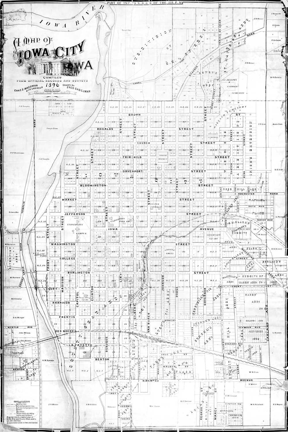
This map is titled, “A Map of Iowa City, Iowa: Compiled from Official Records and Surveys”. The map has an official date of 1896, and lists the creators as Chas. S. Magowan and Fred Gabelman.
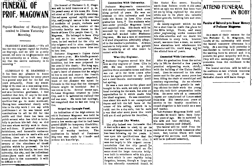
Professor Charles S. Magowan was the City Engineer of Iowa City for many years. He held the position from 1893-1896 and 1899-1907. This is particularly impressive considering that the position of City Engineer was appointed by the Mayor, and was subject to change every other year or so. Along with the title of City Engineer, Professor Magowan taught municipal and civil engineering at the University of Iowa, likely teaching some of the City Engineers discussed in later posts. He encouraged the City of Iowa City to begin paving roads, to improve the sewers, and he helped design the original Hills Bridge.
In his later years, Professor Magowan took ill. He received financial help from Andrew Carnegie, who had a fund for the assistance of worthy teachers. Mr. Carnegie provided the funding needed to build the Iowa City Public Library a few short years later.

There is less information about available about Fred Gabelman, who is listed as the artist of this map. However, we do know that he graduated with a Bachelor of Science in Civil Engineering from the University of Iowa in 1896. That is the same year as the map was published, so there is a good chance that he worked on the map as a student at the University.

This map includes many features, which are explained in the key on the bottom left-hand side of the map. You can find lot and property lines, sewer lines, gas lines, and water main lines on the map, along with street names, landmark names, subdivision names, and property owner names.

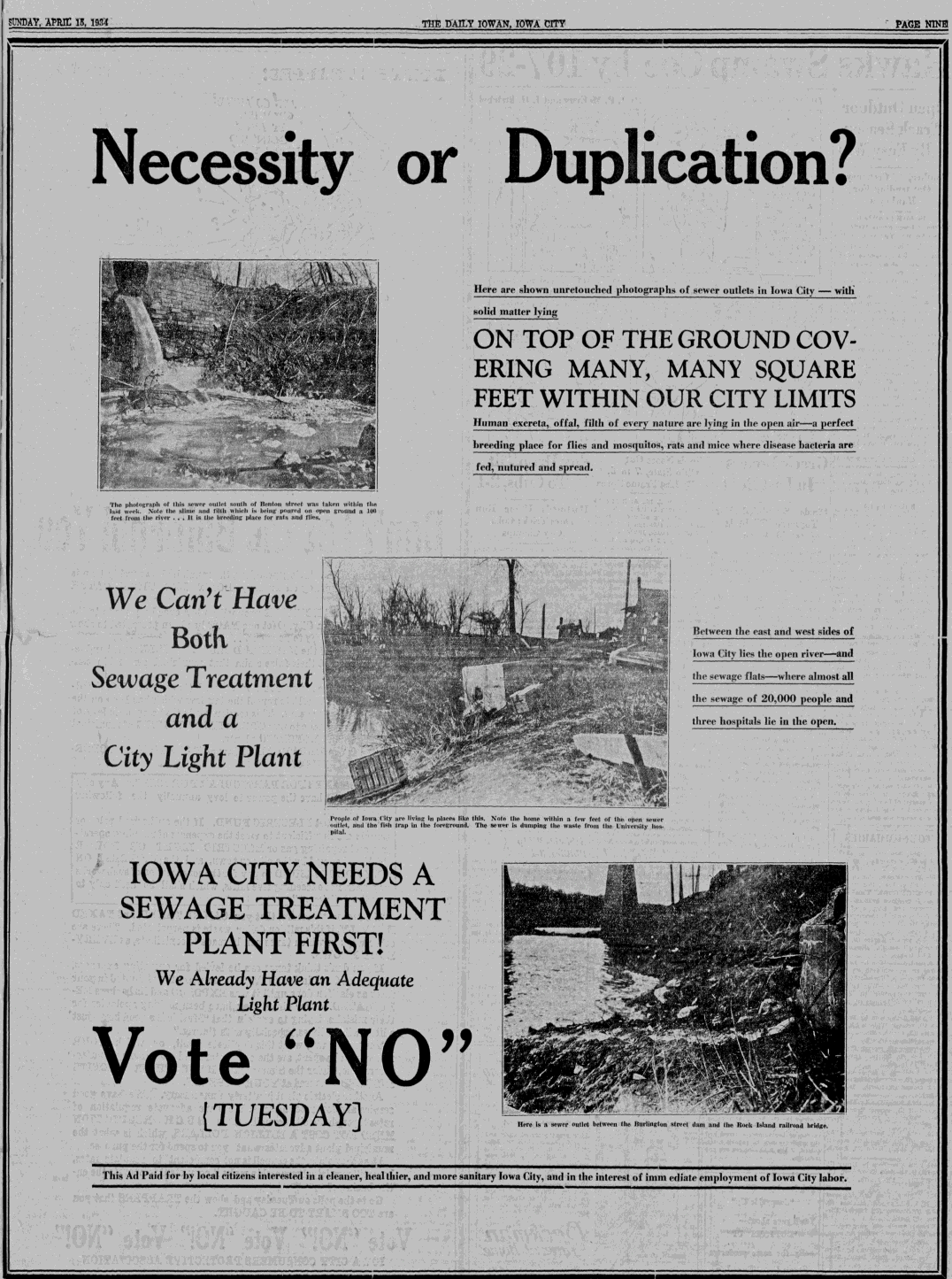
Fun Fact! The water system in Iowa City was fairly new at this time, having started in 1888, less than ten years earlier. Although the water system was new, the sewer system was not. It had started long ago and used some construction techniques that were similar to those used in Roman sewers. Despite the early advent of the sewer system, Iowa City didn’t get a wastewater plant until late 1935. That means that before then, all waste water flowed back into the local rivers.

It is unknown who donated this map to the Iowa City Public Library.
Historical Maps Collection Overview
Sources:
“Funeral of Prof. Magowan.” (1907, Nov 15). Iowa Citizen. Retrieved from Newspaper Archive via the Iowa City Public Library
“Degrees for Many.” (1896, Jun 17). Iowa City Weekly Republican. Retrieved from Historical Iowa City Newspapers via the Iowa City Public Library.
“The City’s Water.” (1900, Aug 11). Daily Iowa State Press. Retrieved from Newspaper Archive via the Iowa City Public Library.
“Council Meets Again.” (1808, Dec 09). Iowa Citizen. Retrieved from Historical Iowa City Newspapers via the Iowa City Public Library.
“City Officials to Start Billing for New Sewage Disposal Plant.” (1935, Nov 23). Daily Iowan. Retrieved from Newspaper Archive via the Iowa City Public Library.
“Necessity or Duplication?” (1934, Apr 17). Daily Iowan. Retrieved from Newspaper Archive via the Iowa City Public Library.
