Posted by Olivia W on Monday, May 15, 2023
The second map in our collection, although not the one with the least amount of information, was the trickiest one to research.
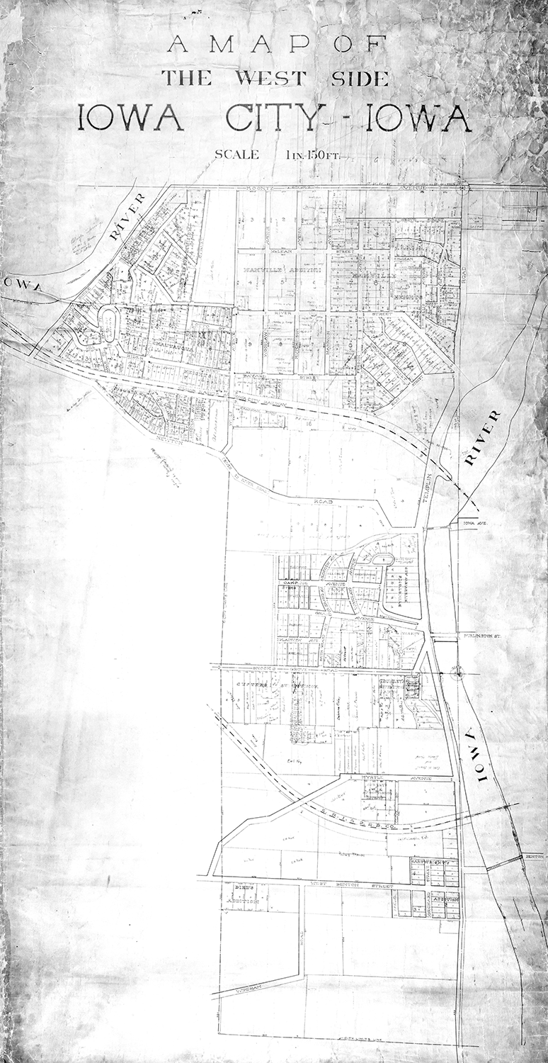
The map is titled, “A Map of The West Side: Iowa City, Iowa”. There are no official names or dates listed on this map, which is part of the reason that research was harder. The other reason that this map was hard to research was all of the handwritten names and dates on the map. I know that sounds counterintuitive, but it appears that these names and dates are not from the original time period of the map.
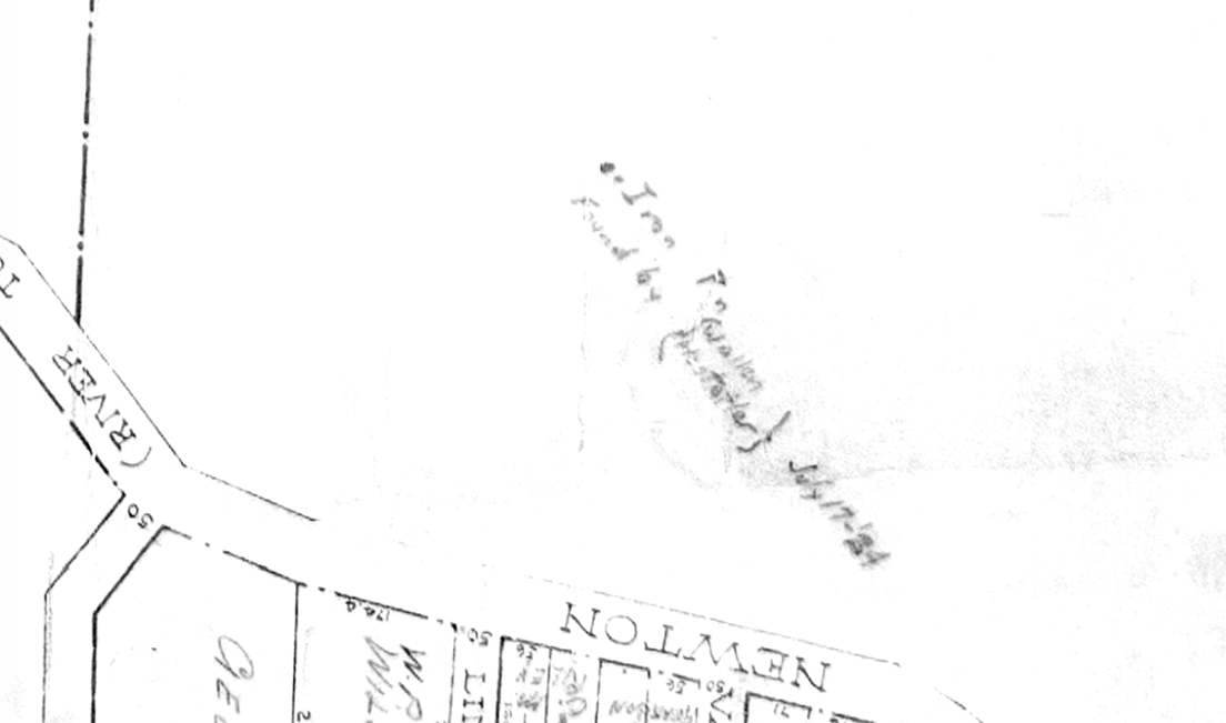
In the center of the map, slightly to the left, you can find a note that says, “Found by {Wallen Hostetler} July 17-’24”. This tells us when the map was found, and potentially the time it was donated to the library – though there are no records that confirm this. However, through the city directories, I found that a majority of the names written in the plats were living there around the 1924 time-range. This leads me to believe that the names on the map were added in after finding it, and are not original to the map.
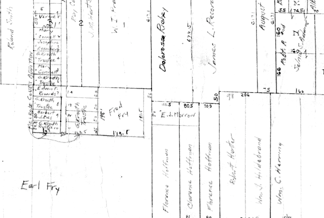
I’m going to take a slight detour, and explore what is known about the two people who found, and possibly donated, the map. The first listed was Wallen. Through searching a combination of newspaper and census records, I was able to match the name Wallen to a man who worked as an engineer with the City of Iowa City. Allen Wallen, born in 1896, was listed as an engineer with the city in the 1930 census. He would have been around 28 or 29 in 1924, which would make sense for someone who had finished university and was working as an engineer.
The other name listed on the map is a bit harder to decipher, but I am almost certain that it is Hostetler. There are two important Hostetler’s of the time, father and son. The first is William Hostetler, born in 1866, who was the head manager of the City of Iowa City’s Water Company. We know that William was not the one who donated the map because he passed away in 1921, after suffering from a chronic illness. The newspapers speculated that William’s sickness started when he heroically dove under high flood waters to repair crucial equipment that stopped the Water Company plant from losing all function.

The Hostetler who likely found the map was Ervin Hostetler, born in 1890. Ervin was William’s son, and appears to have taken up a position as a General Manager at the Water Company only a few years after his father passed. Their marriage announcement states that Ervin’s wife, Edna, also worked in the Water Company offices. Erwin would have been about 33 years old in 1924, which is a similar age to Allen.
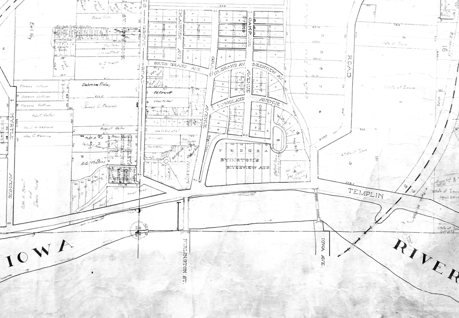
Turning back to the map, I was not able to date the map to a specific year. However, through comparing our map to other maps of the period, I was able to find a date range in which the map was most likely created. The maps that I compared ours to came from the University of Iowa’s Digital Library, and are cited in my sources. Comparing details along the Iowa River – bridges and subdivision names – our map matches a 1906 map.
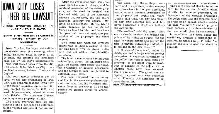
I then took a deeper dive into when the bridges were built, and the Benton Street bridge proved to be some help. The Benton Street bridge began construction in the early 1900’s, though did not get completed until late in 1903 or early in 1904 due to issues with the construction company. However, there were land disputes around the bridge and Benton street beginning in 1903 that did not get settled until late 1906 and early 1907. This, along with the map from 1906, leads me to believe that our map was likely created during or after 1906.
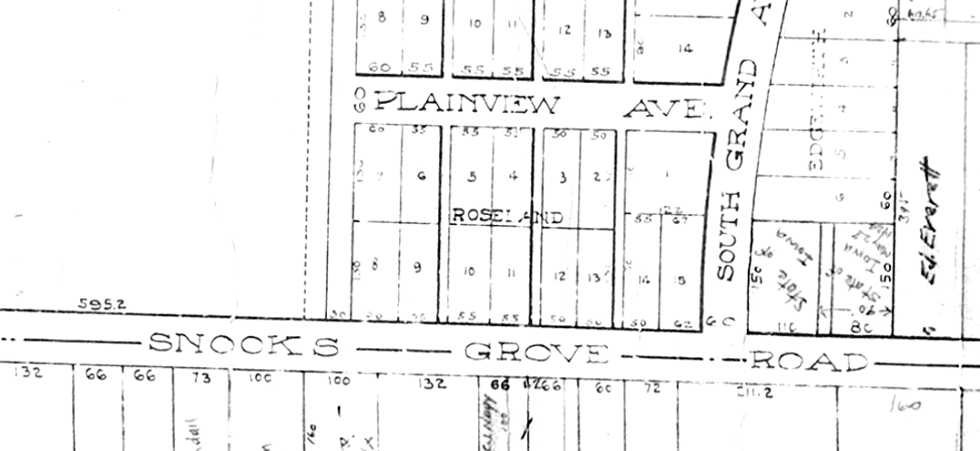
Looking through maps from the 1910’s, I found that the road Snooks Grove was renamed Melrose Ave in 1918. Our map still lists it as Snooks Grove RD, so that gives us an end date of 1917. Therefore, this map was likely created between 1906 and 1917, although I suspect it was created in the early 1910’s to have been lost and re-found by 1924.
We know exactly which City Engineer created the first map, but there is a little bit more mystery for this one. As I mentioned in the previous blog post, the position of City Engineer was appointed by the Mayor, and was subject to change every one to two years. There was a lot of change in the time period that we’ve found for this map. Six people held the position of City Engineer in those 11 years. I was able to find their names and the dates they served through newspaper announcements of the Mayor’s appointments. Their names and dates are: Charles S. Magowan, 1899-1907; J. Otto Schulze, 1907-1909; Curtis T. Dey, 1909-1911 & 1917; Joe C. Watkins, 1911-1914; Homer Hughes, 1915-1917; and Stanley Hands, 1917.
Although there is no key on this map, it has many of the same features as the previous map we looked at. There are section lines, lot lines, and property lines, street names, subdivision names, railroads, and some property owner names, along with the names of property holders who were likely added later. If some of the markings on this map are confusing, it might be helpful to refer to the key on the first map, as they use many of the same markings.
Historical Maps Collection Overview. ; Historical Maps Collection - A Map of Iowa City, Iowa.
Source:
U.S. Census Bureau. (1930, Apr 22). Fifteenth Census of the United States, 1930. Retrieved from Ancestry.com via the Iowa City Public Library.
“Flood Periled Life of Brave W.A. Hostetler.” (1921, Mar 08). Iowa City Press Citizen. Retrieved from Newspaper Archive via the Iowa City Public Library.
“Death Claims Splendid Man W.A. Hostetler.” (1921, Mar 02). Iowa City Press Citizen. Retrieved from Newspaper Archive via the Iowa City Public Library.
State Historical Society of Iowa. (1942, Jan 08). Iowa Birth Records, 1888-1904 : Delayed Certificate of Birth. Retrieved from Ancestry.com via the Iowa City Public Library.
“Lewis-Hostetler.” (1921, Oct 29). Iowa City Press Citizen. Retrieved from Newspaper Archive via the Iowa City Public Library.
“Funeral of Prof. Magowan.” (1907, Nov 15). Iowa Citizen. Retrieved from Newspaper Archive via the Iowa City Public Library
“New Mayor and Council Are Now In.” (1911, Apr 04). Iowa City Citizen. Retrieved from Historical Iowa City Newspapers via the Iowa City Public Library.
“More Paving is Under Contract.” (1907, May 29). Iowa City Daily Press. Retrieved from Historical Iowa City Newspapers via the Iowa City Public Library.
“Iowa City Loses Her Big Lawsuit” (1905, May 8) Iowa City Daily Press. Retrieved from Historical Iowa City Newspapers via the Iowa City Public Library.
“Buy Pieces of Street.” (1907, Feb 20) Iowa City Daily Press. Retrieved from Historical Iowa City Newspapers via the Iowa City Public Library.
“Proceedings of the Board of Supervisors of Johnson County.” (1903, Jun 13). Daily Iowa State Press. Retrieved from Historical Iowa City Newspapers via the Iowa City Public Library.
“Mayor And Council Gave Plums Away.” (1909, Apr 6) Iowa City Republican. Retrieved from Historical Iowa City Newspapers via the Iowa City Public Library.
“Officers for City Service Newly-Chosen.” (1915, Apr 6) Iowa City Daily Press. Retrieved from Historical Iowa City Newspapers via the Iowa City Public Library.
“Mezik is Named Chief of Police.” (1917, Apr 2) Iowa City Daily Citizen. Retrieved from Historical Iowa City Newspapers via the Iowa City Public Library.
Orson B. Poore (Cartographer). 1906. “Iowa City, Iowa.” Retrieved from https://digital.lib.uiowa.edu/islandora/object/ui%3Asheetmaps_52
University of Iowa (Cartographer). 1918-1919. “University of Iowa Campus Map.” Retrieved from https://digital.lib.uiowa.edu/islandora/object/ui%3Aucm_34
University of Iowa (Cartographer). 1916-1917. “University of Iowa Campus Map.” Retrieved from https://digital.lib.uiowa.edu/islandora/object/ui%3Aucm_140
