Posted by Olivia W on Wednesday, May 10, 2023
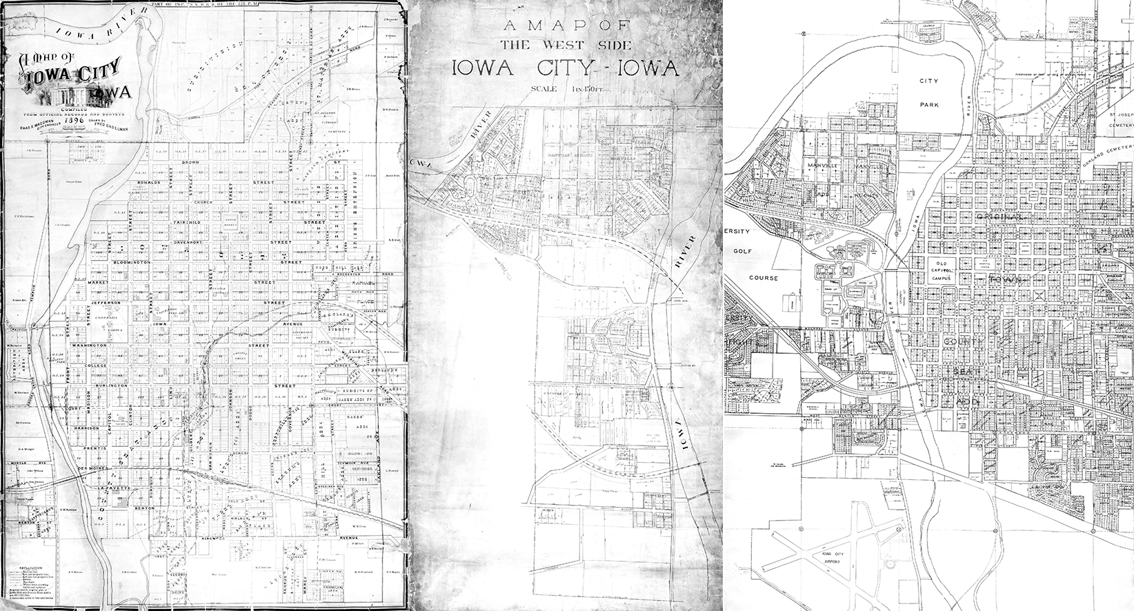
If you’ve walked around the second floor of the Iowa City Public Library in the last couple years, you may have noticed the old Iowa City maps hanging on the back wall near the Page Station.
These maps were unearthed from the Library’s archival collection in 2016. There was little information on how or when we had acquired these maps, or why they had been given to us. It was clear that the maps were in need of conservation work. Although the maps were in varying conditions, they all needed work to prevent further deterioration, especially as they’d been stored rolled up.

This level of conservation work is a bit out of the norm for the librarians at ICPL, so the maps got sent off to a specialist for conservation and digitization. As the maps started to come back to ICPL, they got framed and hung for the public to view. However, there was still very little known about the maps – only one out of the three had any sort of official name and date attached to it.
Fairly soon after displaying all the maps, the Covid-19 pandemic hit and researching the maps went to the back burner. Three years later, it was well past time to do a deep dive into the history of our maps.

The three historical maps are all considered a type of Cadastral or Plat Map, with plat map being the term generally used in the United States. A plat map shows the boundaries and ownership of land parcels. If it gets reviewed by the local government, it can be used for both land valuation and taxation purposes. Creating a plat map is an important step when incorporating a town or city in the United States. There are also other reasons to create plat maps. Those reasons include the subdivision or consolidation of privately-owned land, the designation of neighborhoods and public land, ensuring compliance with zoning, and ensuring that all properties have public right of way and access to city utilities.
With all these official uses, it is easy to see why plat maps are important to cities and local governments. Plat maps are still used today. If you are interested in current plat maps, you can order one from the Johnson County Auditor for a fee, or you can use the digital property viewer provided by Johnson County for free.
This series of blog posts will include an in-depth look into the history of each map, including some local history surrounding the people involved in their creation.
